The City of Philadelphia has launched an online interactive map that shows the locations of street and sidewalk closure permits. The permit information includes the permit holder, the type of work being done, and the right-of-way permit’s effective and expiration dates.
The map is publicly accessible, and updated every 30 minutes. The purpose of the map is to help manage questions about whether streets may or may not be blocked for extended periods of time.
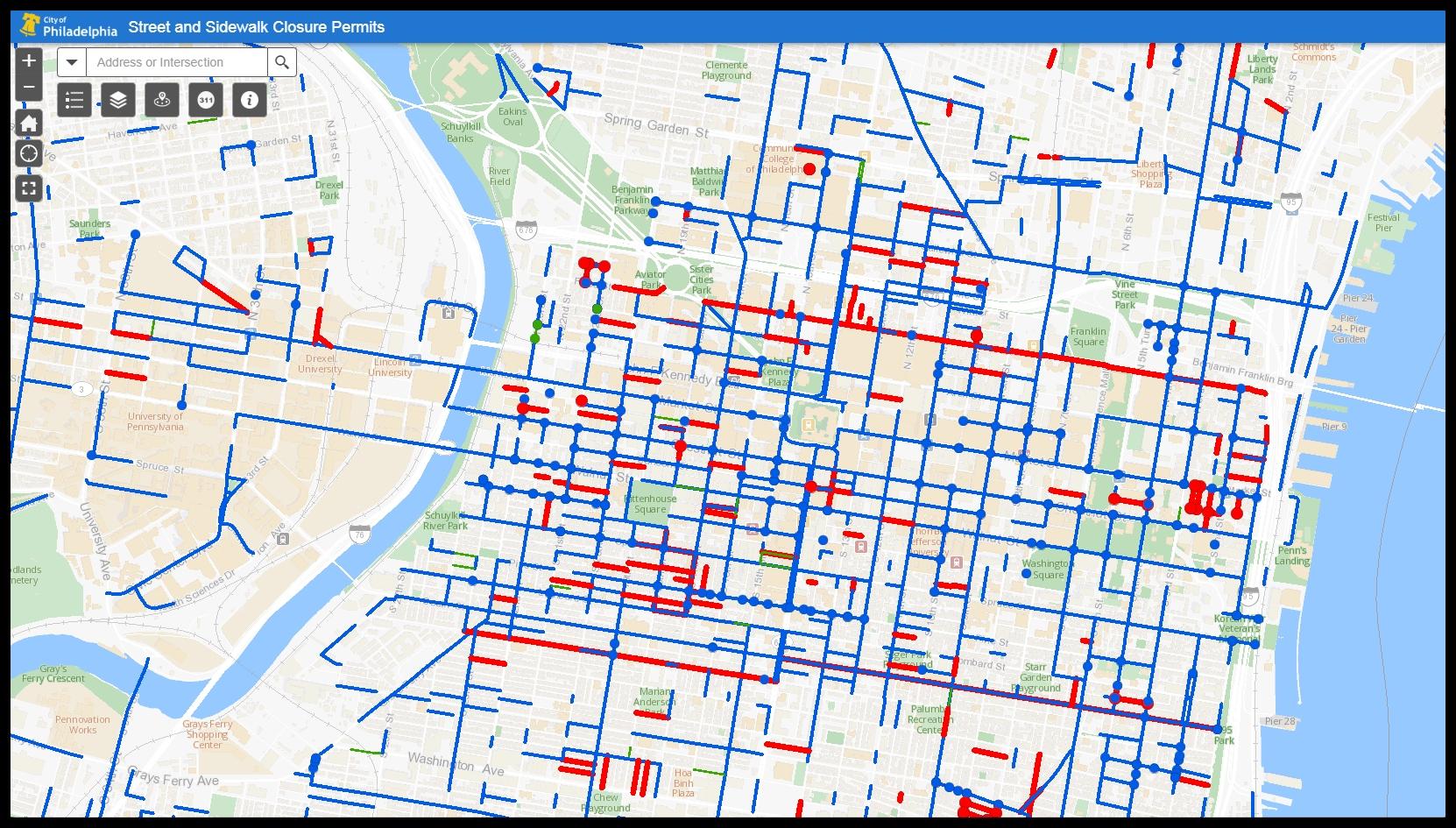
See the interactive map:

From Philly.com:
The interactive map from the Streets Department provides a view of work that disrupts Philadelphia’s streets, with blue lines indicating a partial street closure, green a sidewalk closure, and red a total street closure. The site is comprehensive, cataloging all closures, including those due to street maintenance, utility work, and construction. Even a brief closure caused by someone moving into a new home is cataloged. The information on the site updates every 30 minutes.
A user can click on any location within the city, or search by address, to see the work being done, and the right-of-way permit’s effective and expiration dates. The site also allows users to read the permits themselves. The map shows just how much is being done on Philadelphia’s streets at any one time. At 15th and Chestnut Streets, for example, there are 15 active permits, showing closures for conduit installation, high-rise construction, and window cleaning.
Read more from Philly.com: